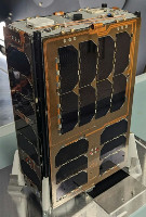
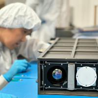
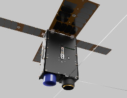
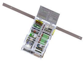
| Name | HyTI (Hyperspectral Thermal Imager) |
|---|---|
| Form factor | CubeSat |
| Units or mass | 6U |
| Status | Reentry 2024-12-17? Was operational (Official website, last checked 2024-05-26) |
| Launched | 2024-03-21 |
| NORAD ID | 59561 ? |
| Deployer | NRCSD (NanoRacks CubeSat Deployer) [Quad-M] |
| Launcher | Falcon 9 (CRS-30) (ELaNa 51) |
| Deployment | Deployed from ISS on 2024-04-18 |
| Organisation | University of Hawai’i at Mānoa |
| Institution | University |
| Entity | Academic / Education |
| Nation (HQ) | US |
| Nation (AIT) | Netherlands |
| Manufacturer | AIVT by ISISpace |
| Partners | Hawaii Institute of Geophysics and Planetology (HIGP), West Coast Solutions, Quest Unlimited, American Infrared (AIRS), SaraniaSat, New England Optical Systems (NEOS), Unibap, NASA Jet Propulsion Laboratory |
| Oneliner |
Demonstrate long-wave infrared imager to monitor water resources. |
| Description |
Demonstrate how high spatial resolution (60 m ground resolution element), high spectral resolution (25 bands) and long-wave infrared image data can be acquired to monitor water resources using a 6U CubeSat. HyTI will map irrigated and rainfed cropland, determine crop water use and establish crop water productivity of major world crops. |
| Sources | [1] [2] [3] [4] [5] [6] [7] [8] |
| Photo sources | [1] [2] [3] [4] [5] [6] [7] |
| COTS subsystems |
|
| Subsystems sources | [1] [2] |
Last modified: 2024-12-31
